I guess I’ll apologize in advance, this is going to be a long blog, but the pictures are worth it, I swear!
After dropping Erika the Fiddler off at her car, I headed in to Te Anau to do some laundry and try to get reset for the next phase of the adventure—The Rees Dart track. The plan was to take care of stuff in Te Anau, drive to Mossburn (about 45 minutes away) to spend the night and get cleaned up. In the morning, I would drive to Queenstown to pick up my friend Bev and we would head to the start of the track.
In my head, it seemed like a great plan.
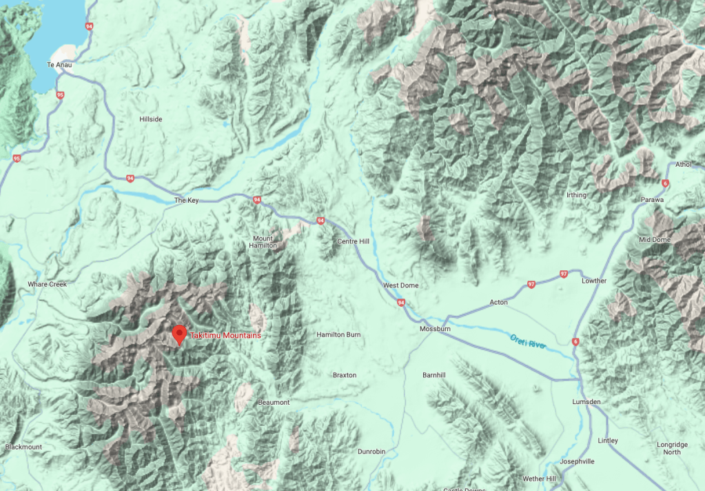
Way back in 1986, I was doing my Masters degree field work in the Takitimu Mountains, just outside of Mossburn. After finishing several months of field work, I decided to treat myself to a night in a hotel (I was a poor graduate student) to celebrate. I found a little pub/hotel in Mossburn called the Mossburn Railway Hotel. It turned out to be Friday night and I ended up drinking way too much beer with a bunch of locals, playing darts, watching cricket, and generally being the good natured brunt of a lot of jokes. It was a hoot and was a true local experience.
As I was planning this adventure and had decided I needed one night to get showered and transitioned from Kepler to Rees Dart, I saw the Mossburn Railway Hotel! I had to book it. A 38-year gap between stays.
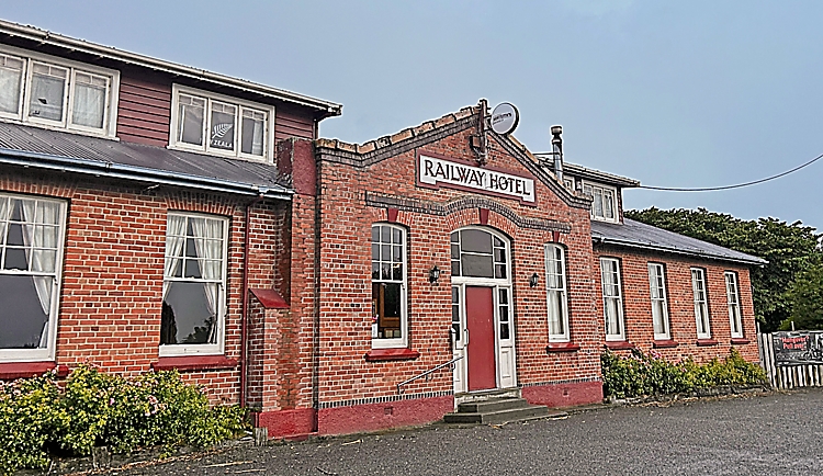
I got to the hotel around 5 and checked in. It looked surprisingly the same as it did 38 years ago. The woman asked if I had stayed there before and I said “yes, just 38 years ago!” She laughed and I told her the story of when I was there last. She showed me to my room and I gratefully headed to the shower. It felt good to get cleaned up after 9 days without.
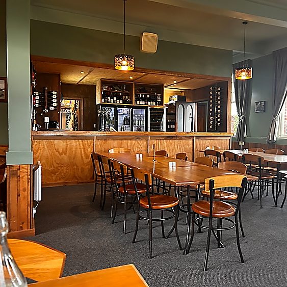
I headed into the restaurant and there were a few local kiwis having dinner. They had to open up the bar area for me as there was nothing available in the dining room. Sadly, the dart board was no longer there and it looked generally a lot more upscale than I had remembered.
I ordered the lamb shank and a nice glass of wine. That sounded way mo betta than freeze dried food!

As I was eating my incredibly excellent lamb, two people sat in the table next to me. Turns out they were Americans who worked for a logistics company and more importantly were huge into fly fishing. Evidently, this part of New Zealand is ground zero for some of the best fly fishing in the world. Shortly thereafter, a group of folks they worked with that were investors(?) in some type of fly fishing guiding company showed up. Then the owner told me there was another American in the restaurant that had first come here 35 years ago. After dinner, I went and chatted with Paco from Michigan who also had a place in Wanaka. It was Americans everywhere! Who knew that little ole Mossburn is the height of high-end fly fishing.
It was fun, but wasn’t quite the small town kiwi experience I was expecting from 38 years ago. When I paid my bill, I said to the woman “What’s with all these Americans? They are ruining the place!” She laughed at the irony of my statement.
I texted with Bev to let him know the plan for the next day. I was going to get up early and drive to Queenstown and pick him up and from his hotel and head out to the Rees Dart trailhead. My goal was to get going by no later than 6:30 am. He sounded a bit nervous and I told him two things—one was true and one was not: (a) In all my years of taking people on adventures, I had not lost a single one of them and (b) Rees Dart was a small step up in difficulty from Kepler. He sounded relieved about both facts.
A huge front moved in that night and the wind blew like a hurricane. It made me wonder if we might have to delay a day to start Rees Dart, but I figured I would assess in the morning. Sadly the morning came way too quick and I immediately regretted the second glass of wine from the night before. Doh!
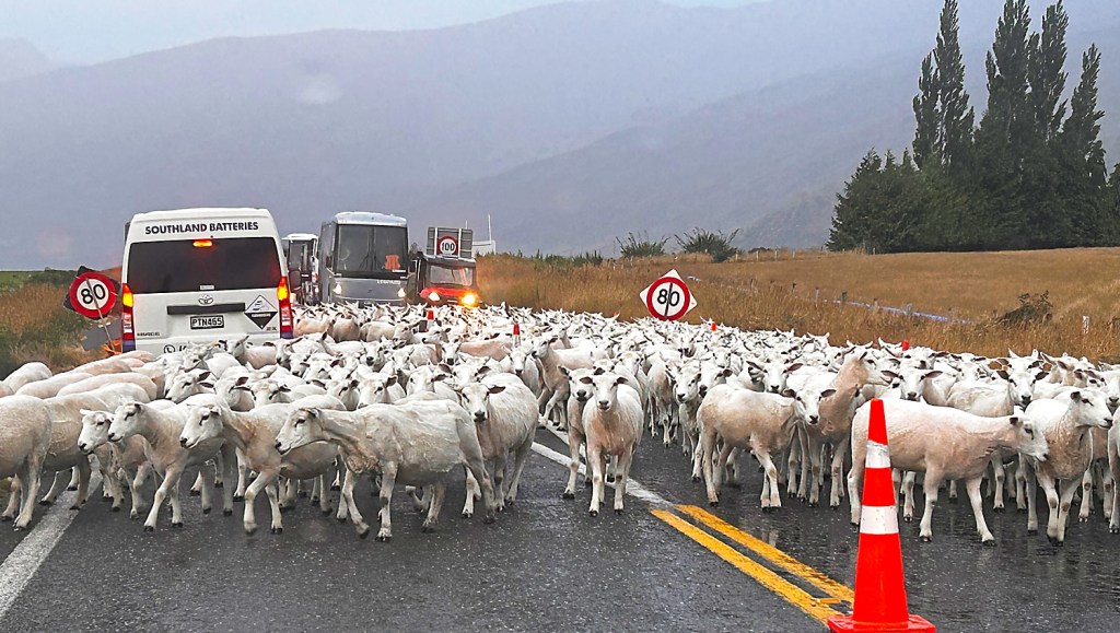
I got on the road, stopped in Garston to get a coffee and immediately got stuck in traffic. Not the usual traffic, but truly New Zealand traffic. I texted Bev and told him I would be about 15 minutes late. Although it was raining, it was not windy and you could see the clouds clearing. Maybe it would be a go after all.
Queenstown is like Las Vegas for me. The stuff around Vegas is amazing. Virgin River canyon, Flaming rocks, Grand Canyon. But Vegas, yuk. Hate it. Can’t get out of it fast enough. Queenstown is like that for me. Everything around it is amazing, the town…bleh. Can’t get out of it fast enough. I drove to Bev’s hotel and went to the wrong one.

I finally found it and we went to a covered parking garage so I could repack. I was regretting not putting a rest day between the two tramps and now I was feeling rushed and disorganized. I am normally very methodical with my packing, but this was not that.
We drove out to Glenorchy and the skies were clearing and it was a cracker day! Amazing. For the second time on the trip where I thought I was going to have to hike in the rain, it just cleared out and was beautiful. Note to self: I must remember to deposit some more good karma in the account when I get home. We picked up the lock box from the car shuttle people and drove out to Muddy Creek trailhead—the start of the Rees Dart track.
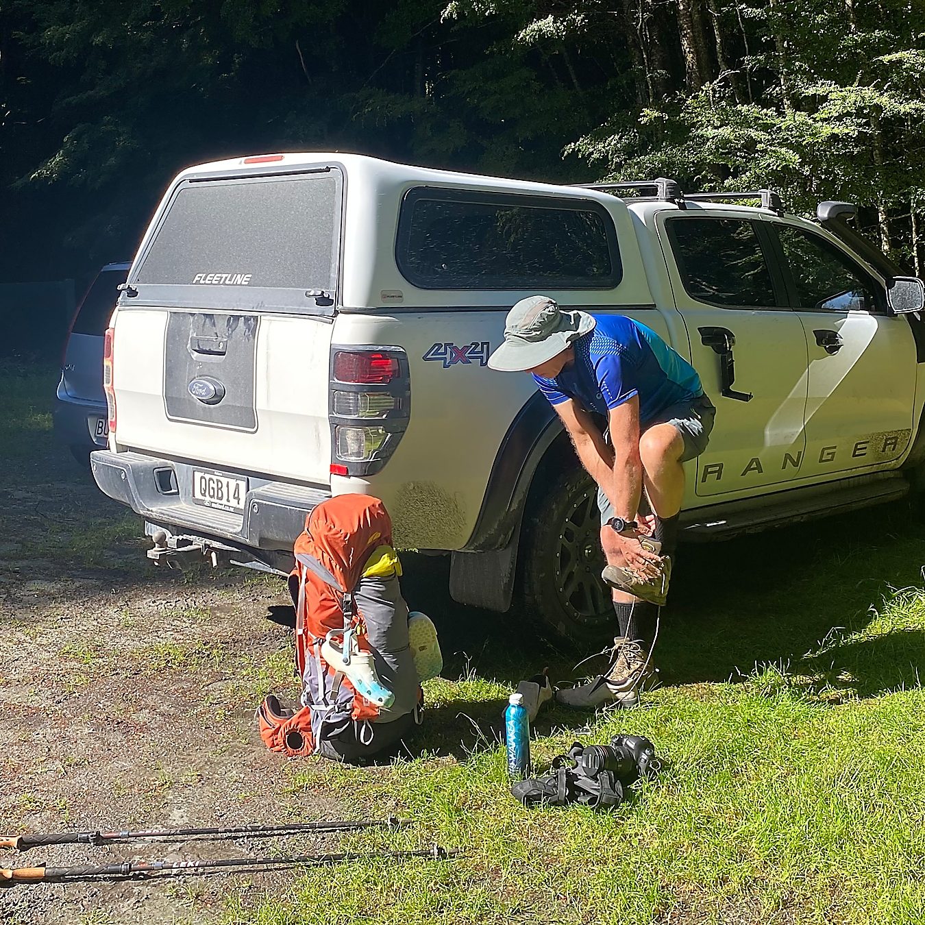
We got there around 11 am. Perfect, the plan was working as designed … other than my continued disorganization with my stuff. Bev patiently waited while I futzed around forgetting things and trying to get it together. Doh.
The good news was the bugs weren’t bad and the weather was great for the start of the trip. Yeah for us!
I should probably remind you of the story about how Bev ended up on this trip with me. As I was planning this adventurefest, I needed to get someone to take care of our chickens and Bee & Bev are our go to for that.
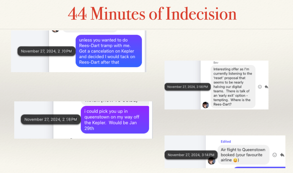
While texting him the dates that I would need help, I casually added to a message “unless you want to do Rees Dart with me.” It took a whopping 44 minutes to go from concept to airplane ticket purchase. Now that is decisive!
Anyway, off we went on our adventure.

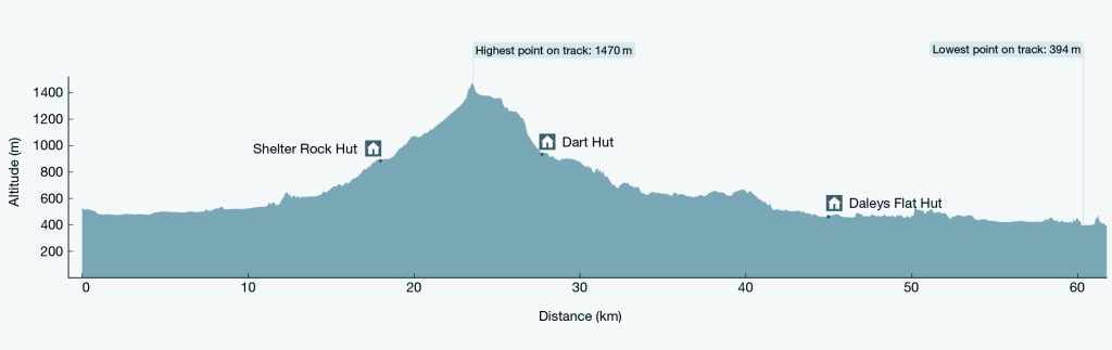
Let me first orient you to where Rees Dart is and what the trail profile looks like. It is just to the Northwest of Queenstown in Mt. Aspiring National Park.
We planned to do a 5 day/4 night version that included a day going up to Cascade Saddle and back.
When you look at the profile it really doesn’t look too tough, but the DOC does rate the tramp as “Advanced.”
Some of the various blogs and warnings do tell you to be prepared for adverse conditions and have experience with creek crossing as you might get stuck there for a few days. This is subtle kiwi for “harder than you think.”
Day 1: The Bog Slog
(Muddy Creek Trailhead to Shelter Rock Hut, 21 km)
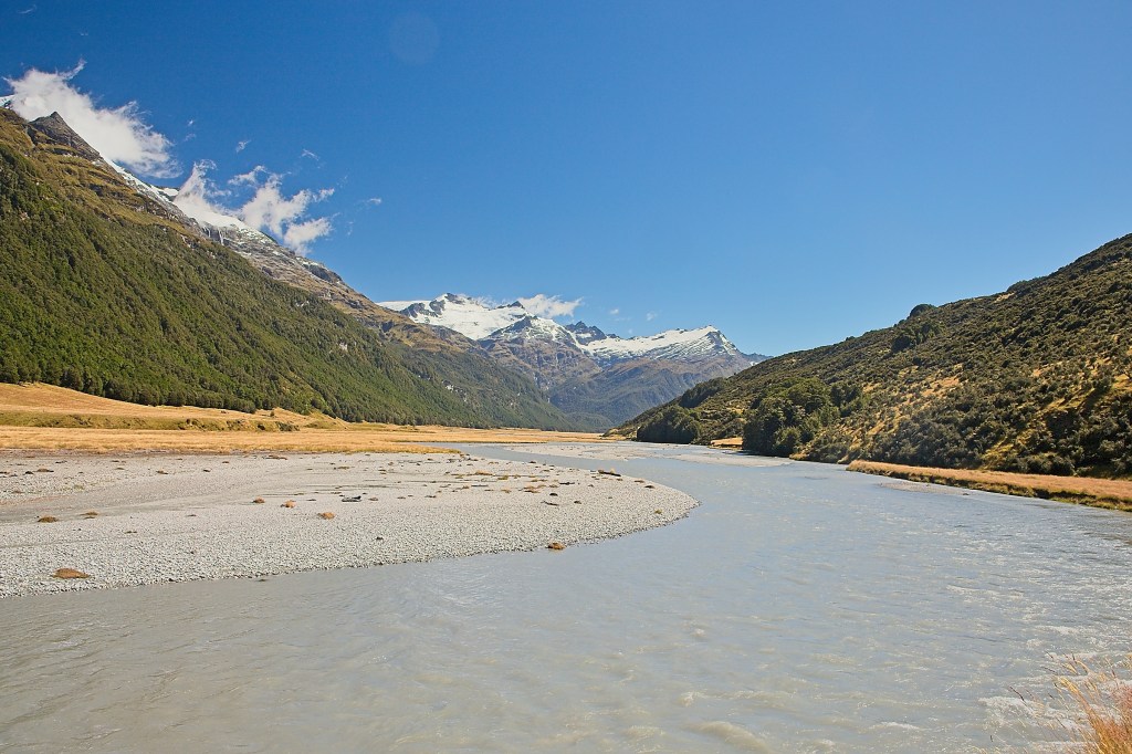
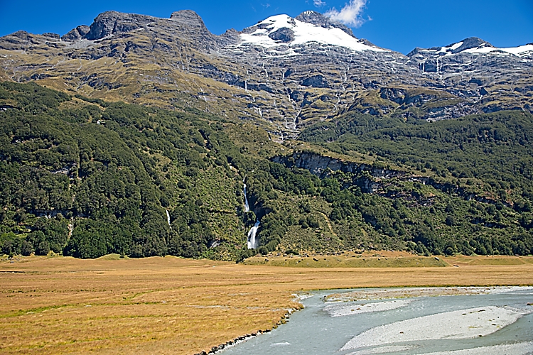
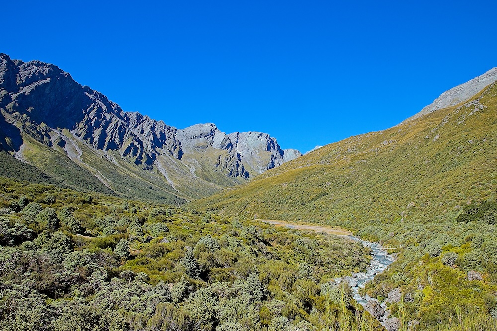
The first 12 kms of the trail traverse up the Rees Valley across private property owned by the Rees Valley Station. It is a classic glacial floor valley. Flat with a braided river running through it. Easy peasy. One small complication to that is that where it is not river bank, it is a bog.
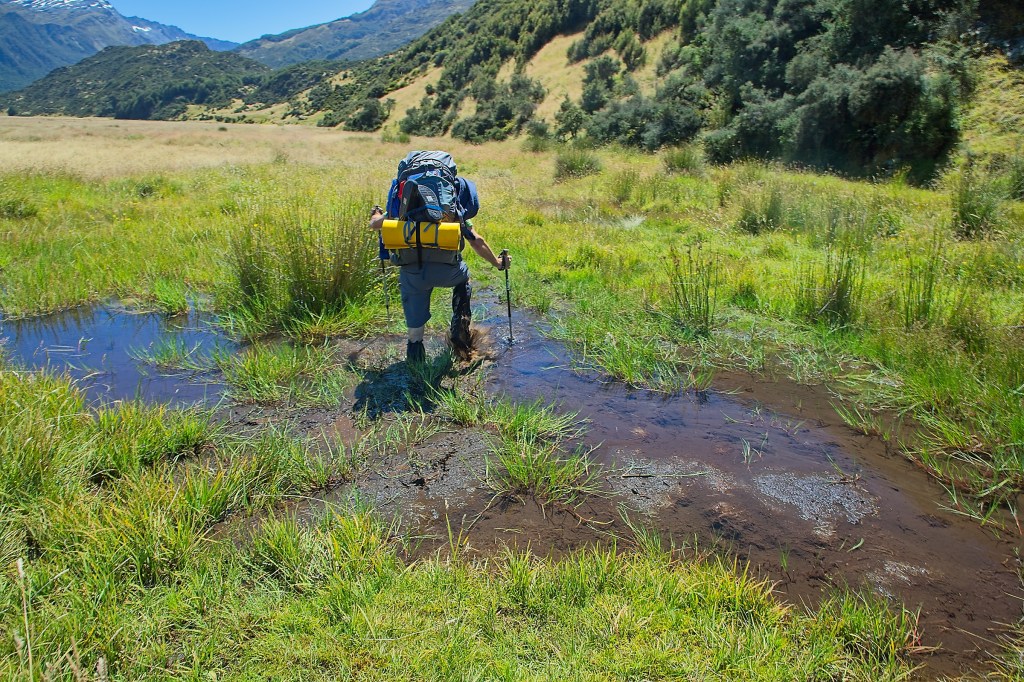
Various trip reports described the first part of the hike as “annoying”. Several suggested that you cross the Rees River and follow the 4 wheel drive track rather than suffer through the mud. This all sounded like sage advice, however, because it had rained so hard the night before, there was no way to cross the Rees river without going for an extended rafting trip floating on your pack. Both Bev and I decided that, being so early in the trip, this was probably not advisable. Bog slog it is.
One thing about tramping in New Zealand—one thing you just have to get over—is trying to keep your feet dry. Get over it. Won’t happen. It took all of 4 minutes on this trail for our feet to be soaked to a squishy.
Although the bog was annoying, it wasn’t as bad as I thought it would be. Every now and then you are forced up and out of the river bed and over a knob. This usually involves a bit of a scramble and some hard work, but nothing too bad.
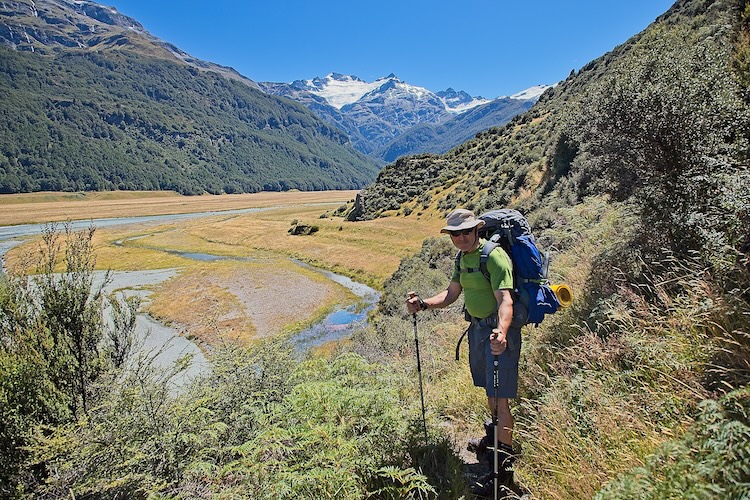
After 25 mile creek, the bog eases up and you just cruise along a grass field that is pretty easy going until you reach the Mt. Aspiring National Park boundary at about 12 km. For some reason, partly due to my lack of appropriate reset, I thought the day was 16 km total, so when we reached the park I was thinking we only had 4 km to go. It turns out the brochure says 19 km, but don’t kid yourself, it is a full 21 km—but I get ahead of myself.


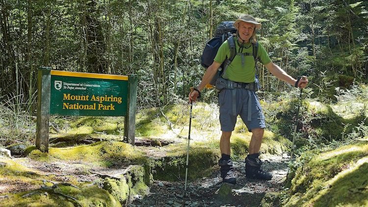
It was nice to get out of the grass field and officially into the park. We stopped by the river, took a food and water break and celebrated our great progress to this point. I confidently stated to Bev that we didn’t have far to go—having only had a little knowledge and over-confidence on the distance of the hike, I was clearly standing on the summit of Mt. Stupid (see previous blog post). Now, I have spent my entire life wandering around the wilderness and one thing I tell people is that you have to keep your eyes open, look for subtle signs and think about what they mean. So while confidently standing on Mt. Stupid, I failed to think about the fact that the sign I was standing next to told me that we were halfway in terms of time.
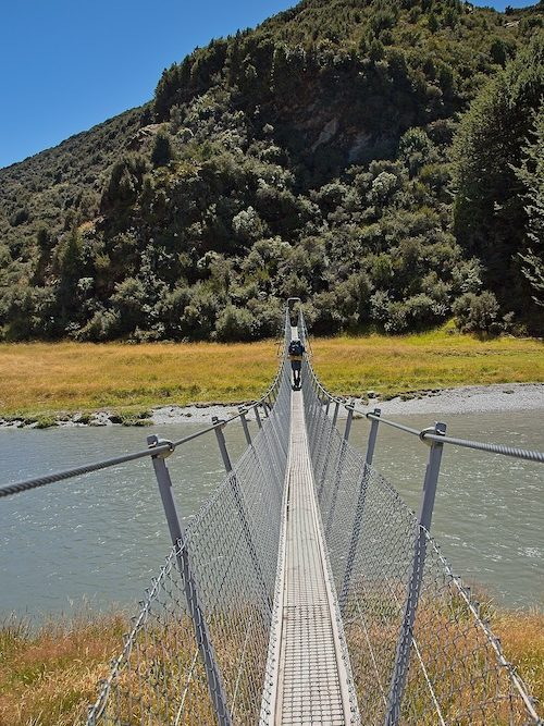
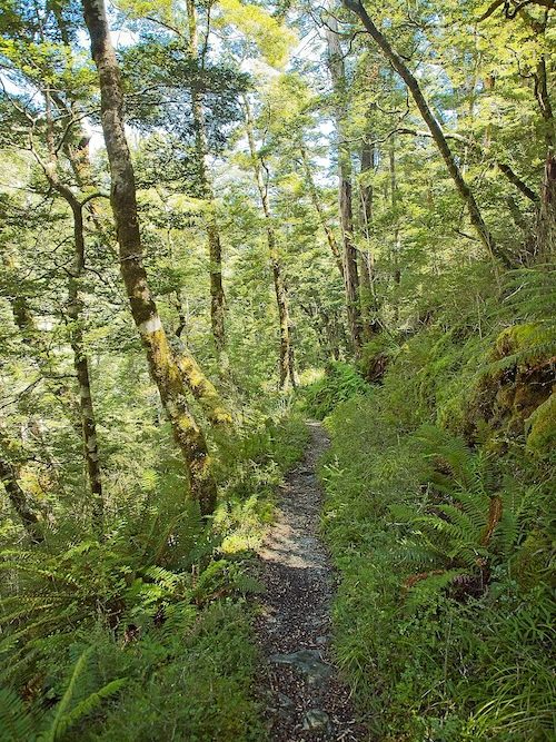
The trail climbs in earnest from this point and the first of a few thousand root ladders, boulder scrambles, and creek crossing begin to show up. The beech forest here is lovely with some beautiful little side steams. The bridge that had been washed out and could have presented a significant obstacle if the water was high was no issue at all. Whew.

Although Bev’s decisiveness in coming on the trip was admirable, it did impede his ability to do much training before hand. As we climbed and the trail got harder, his unshakably positive attitude on life was starting to sag a bit. I was very empathic to his plight.
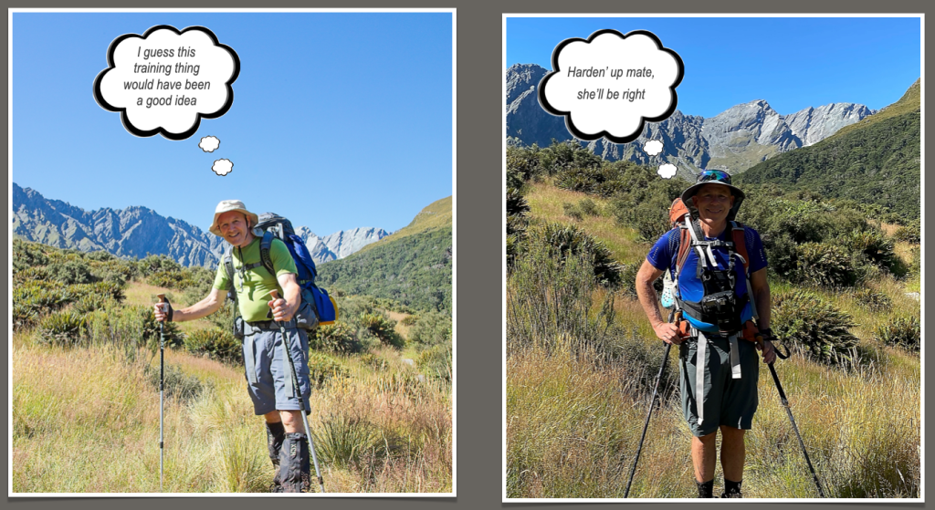
In all honesty when we hit 19 km, mine started to fade as well as the realization that I didn’t know exactly how long the day was going to be sunk in as we both began to tire out.
It seemed like things were going to ease up after we popped out of the trees and into the high alpine meadows. It kept going up, but we were both sure the hut was going to be right there. The other big pisser was that although the contours required to get to the hut were not that many, there were a bunch of deep, rocky gullies that had to be navigated. It was way harder than I would have thought. Bev checked his gps map and it looked like another couple of kms to go. Ugh.
I was getting tired and crabby, so I picked up the pace a bit and boogied toward the hut. Finally I saw the bridge across the river! I made it to the hut, sat down and let out a big sigh of relief. A few minutes later, Bev showed up and did the same. We were both a bit knackered.
We got ourselves sorted and then both stretched out on our bunks and took a nap. That first day was surprisingly hard and it wasn’t 19 km, it is 21+. So if you are doing the hike, set your mental fortitude odometer to 21.4 km. Pretty much everyone that showed up at the hut had the same reaction:
“That was a lot harder than I expected”
After we had recovered a bit, we set about making dinner. Bev’s back and arms were a bit sore so I did the prep. The weird salmon dish that I was skeptical about was on the menu. Turned out to be really good and hearty. We both ate in relative silence, enjoying the infusion of calories.
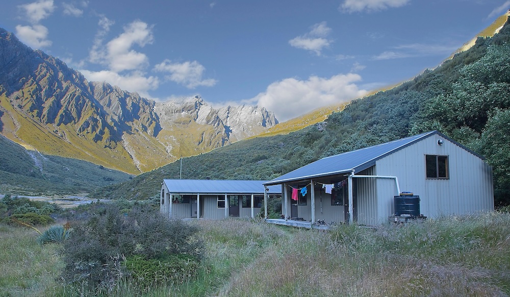
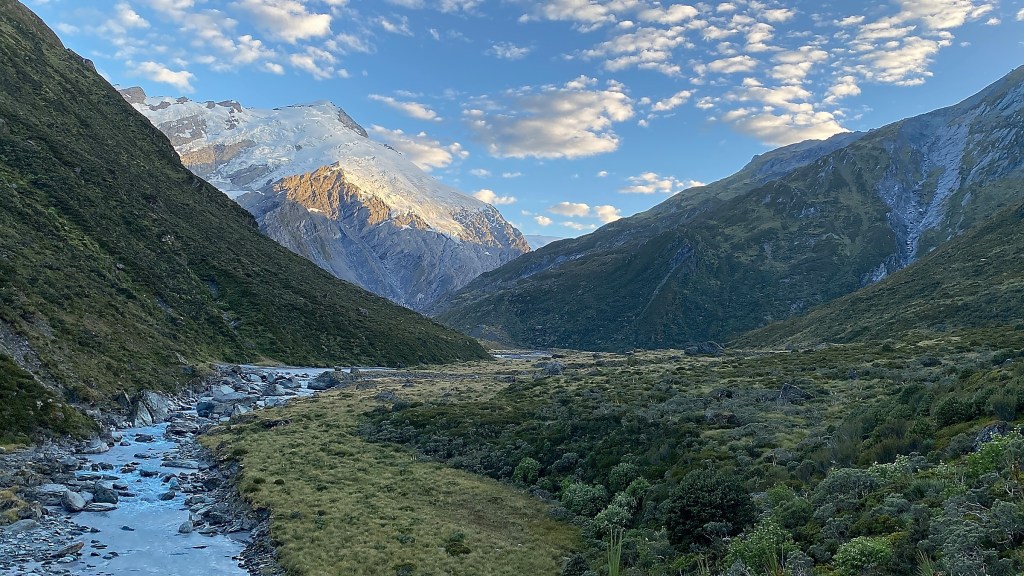
As the sun was setting I managed to get my tired body out to take a few pictures around the hut. Rather than go clubbing, we opted to go to bed at around 8 pm. Nothing wrong with a good night sleep. It was also nice, because the hut wasn’t full and everyone settled down right away.
Although hard, that first day turned out great. What I thought was going to be a rainy sufferfest turned into a bluebird day. Awesome.


Let me know what you think!