
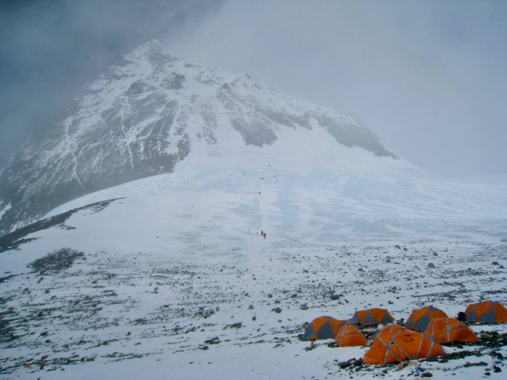
As I lay in my sleeping bag feeling my tent shake and rattle, it made me marvel at these mountaineers who can be huddled in a tent at Camp IV on the top of Lhotse face just below the summit of Everest as a storm rages. It must be terrifying.
I could hear the gusts of wind coming from way down the mountain — long before they hit my location. When they did hit, it left me hoping that whoever had sewn together my tiny little piece of nylon had been a motivated, well-paid worker who wanted to do a good job.
But let me start from the beginning.
Mount Owen is the highest mountain in the Kahurangi Range and stands 1875 m above sea level. Its geology and landforms are quite unique and is 450 million year old limestone that has been recrystallized into marble, uplifted, and subsequently eroded away by glaciers and water into a unique karst terrain.
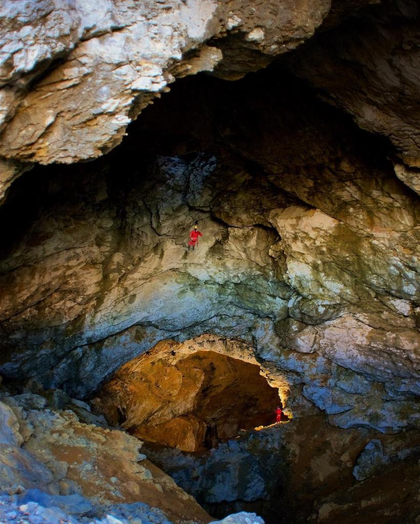
It is home to numerous caves with the longest being the Bulmer Cave at 72.3 km! Evidently, this area is a spelunker’s nirvana with some of the deepest, longest, and most difficult caves to explore. Let’s just say, I do like a good cave tour, but I do not think I am going to explore the Bulmer cave.
I had been wanting to go climb this mountain for quite a while and was feeling that the 300 km of tramping I had done this summer had me in good fitness for the climb; I just needed a good weather window to do it before winter set in. I saw a break in the weather that looked good. Right after a series of big storms a high pressure was setting up, so I thought: now is the time. I got all packed up and headed out in the morning. As I rounded the corner to get on the motorway, I saw that Mt. Arthur was white with snow. Bummer. People had advised that it is not a smart thing to climb Mt. Owen in bad weather or snow. I heeded their advice and sadly pulled the plug 3 minutes into the expedition. Bummer.
The weather for the next several days was spectacular, but I had too many other commitments so couldn’t go. Finally it looked like I might make it up on Monday even though Tuesday looked a bit iffy. I had originally planned to stay at the Granity Pass hut, but then realized it was Easter Holiday and that there was a high probability of it being chocker-block full. So I repacked, this time with my tent, got up early and headed out for the climb.
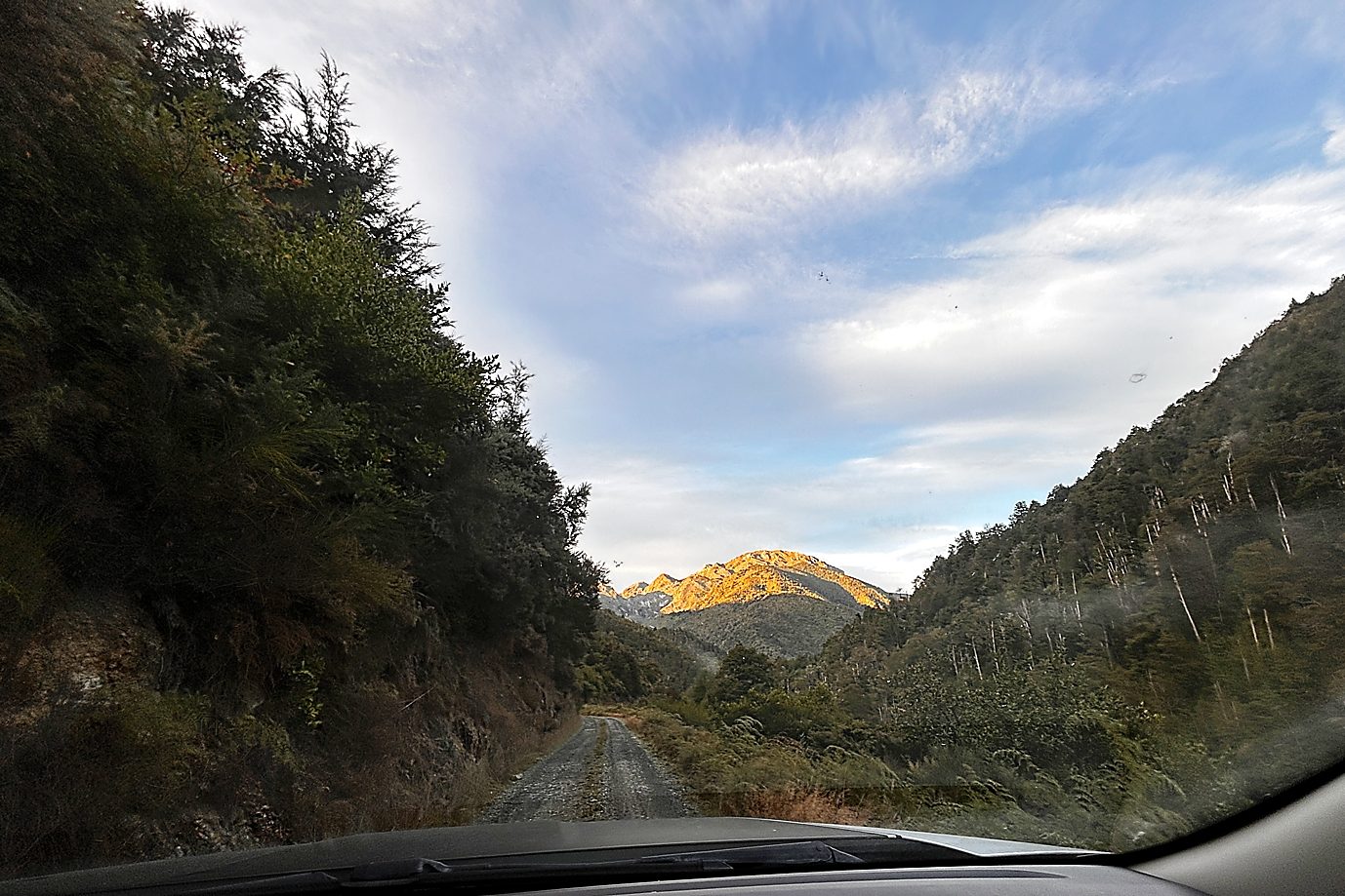
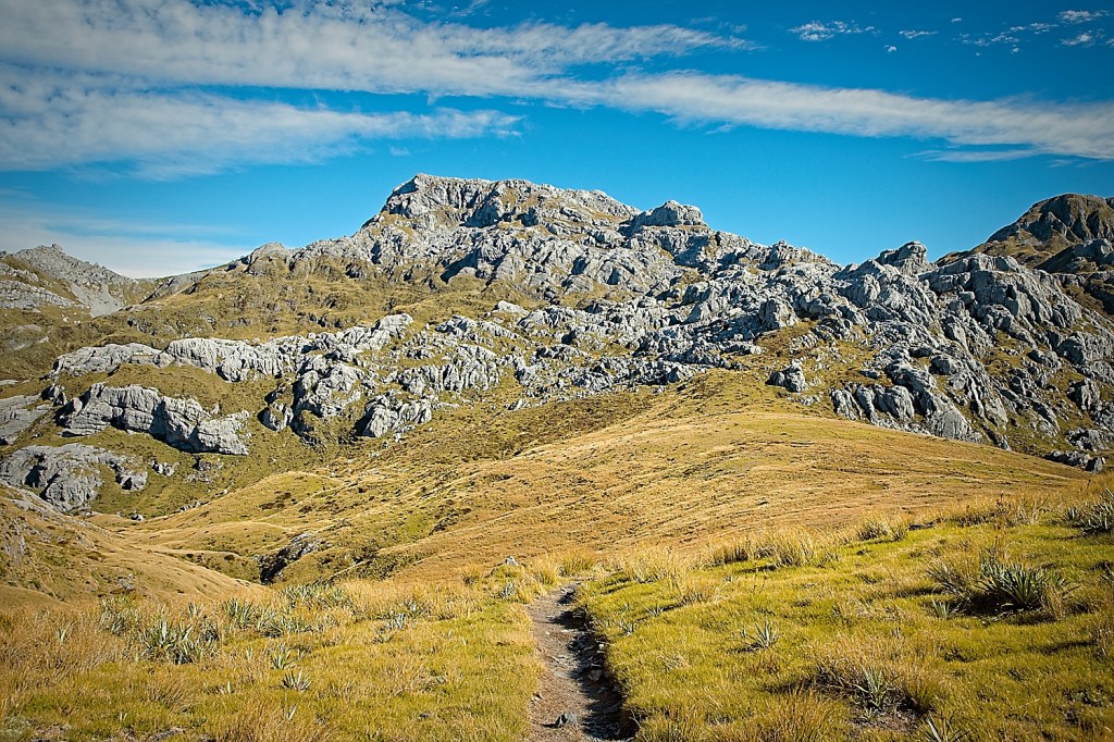
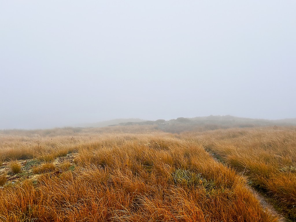
It was a bit chilly at the start and there were definitely a surprising number of cars at the trailhead. There is a choice of two trails at the beginning. One that goes along Blue Creek and another that goes up the ridge. I chose the ridge route as I had read that the trail was a bit sketchy and hard to find along Blue Creek.
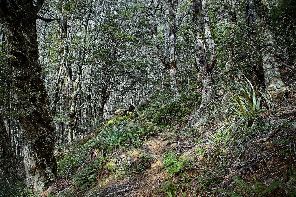
After a few little boggy sections, the trail starts to climb in earnest. The first part of it is sadly a lot of bracken ferns and gorse and the trail was a bit overgrown. It really is a bummer, that gorse. Hate the stuff. I had read that the trail was steep. I think this is an understatement. It is REALLY steep. At the join-up of the Blue Creek and Ridge trails, you have walked 2.9 km but have climbed 450 meters. If you do the math, that is an average grade of 27.7%. Oooooofffffff.
After the trail junction, you get to the beech trees which is a large improvement over the gorse. The bird life was great and the Tuis were singing all over the place. I never get tired of their song. The steepness did not relent much, though. My mantra became “10 meters at a time, dude.”
I reached the top of the ridge portion of the climb and let out a happy sigh that the trail relented in its steepness. I took a break, ate some food and enjoyed the views. A dude showed up, headed down. We chatted for a while and we both complained about how heavy camera gear was. He had watched the sunrise from the top with a full moon. That sounded amazing.
Next up on the trail is a section called the “Staircase.” It is a pretty sharp drop down a limestone cliff that requires a fair amount of scrambling. It isn’t super long with only 150 meter elevation drop, but it did require some attention to ensure that you did not go sailing over the cliff.
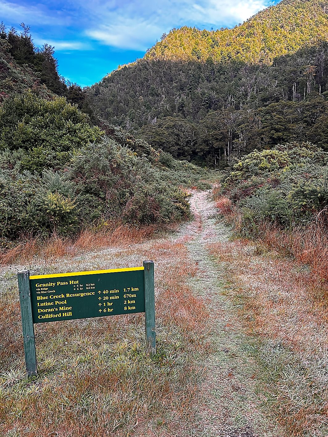
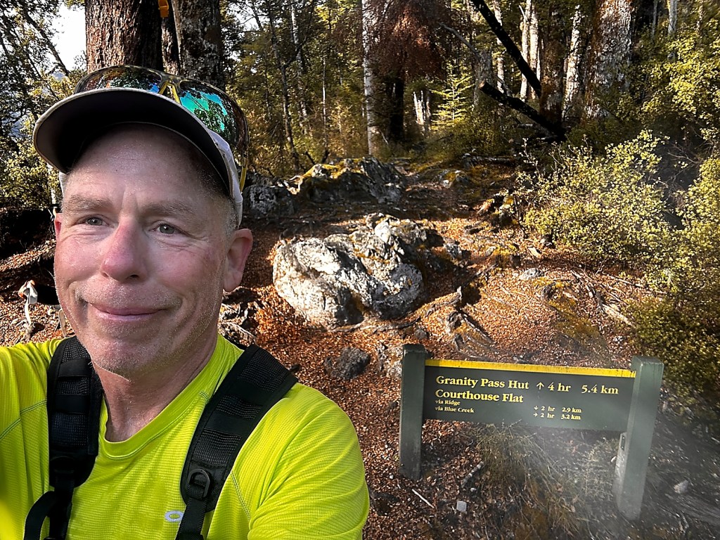
After the drop there was a bit of up and down over some root ladders (ala Rees Dart) but generally the technical section was pretty short. At this point you are in the valley that leads to Granity Pass Hut and the gradient was quite easy.
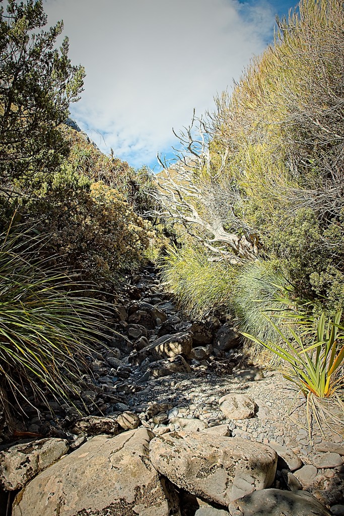
After a kilometer or so the trail drops into Blue Creek and heads right up the bouldery bed. It was bone dry on the way up, so despite looking a bit difficult it was easy-peasy. I reached the hut after about 4.5 hrs of hiking which I thought was pretty good considering I was carrying a full pack. The DOC time had quoted 6 hrs.
One thing to note about this hike is that it does not have a plethora of places to refill with water. It is quite dry due to the very porous nature of the surrounding limestone. I refilled with water at the hut and took a bit of a break. The hut looked totally full, so I was glad I brought the tent. It was quite a nice hut and I will have to stay there next time when it isn’t a holiday weekend.

According to NZed Topo 50 I had about another 300 meters to go to the tarns where I was planning to make camp. I was tired, but at least it wasn’t the 30% slogfest that the first part of the trip entailed.
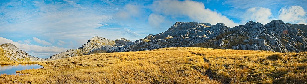
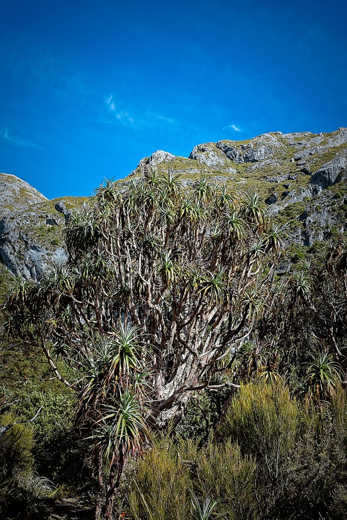
The rock cliffs surrounding me were amazing. I guess this is a great area to come rock climb and I could see why. After the hut, the trail worked its way up along a lateral moraine which was not too steep. Nonetheless, I could feel the day’s effort starting to add up.

As I climbed up what looked to be the last steeper ridge, a bunch of people were coming down. They had stayed at the hut and climbed the peak that day. Hence why the hut looked so full. I said I was camping at the tarns; they confirmed it was beautiful.
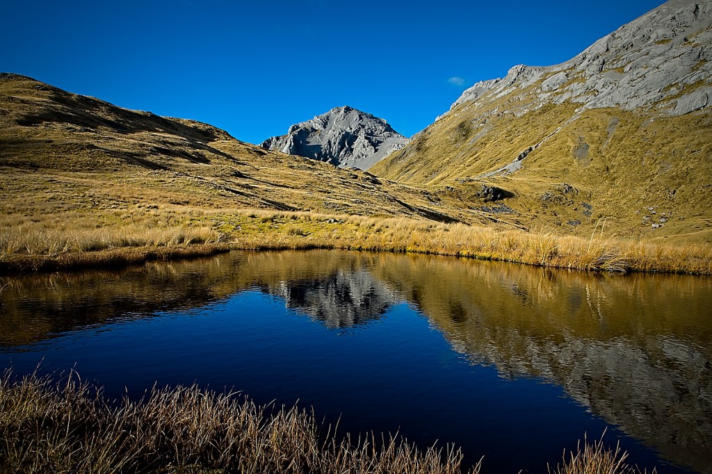
I was slowing down but finally made the top of what I thought was where the tarns were. Sadly these were the lower tarns and weren’t all that great for camping. I wandered around in the tussock for a while until I truly confirmed I had more climbing to do. Wishful thinking did not get rid of the contour lines on the topo map. Ugh.
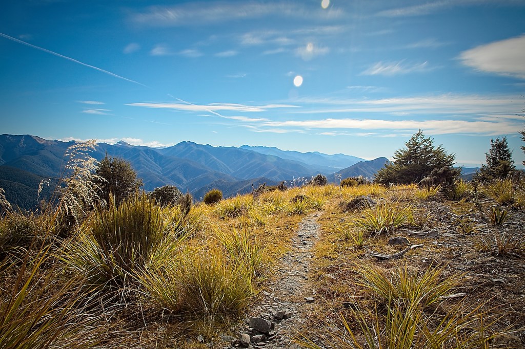
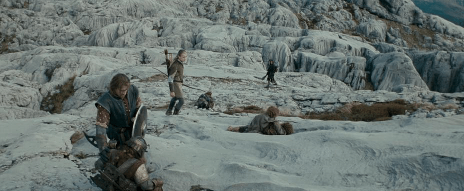
The trail works its way around the east side of Sentinel Hill. It, at first, looks like you are going in the wrong direction, but after you get to the top of the saddle you get to see Mount Owen in all its glory.

If you are a total “Lord of the Rings” nuthead, you will immediately recognize that this is where they shot the scene in “The Fellowship of the Ring” when the fellowship exits the Mines of Moria. If you don’t feel like making the 1600 m climb, but still have a burning need to do all things “Lord of the Rings,” you can actually get a helicopter ride up and wander through Middle Earth without burning 3000 calories.
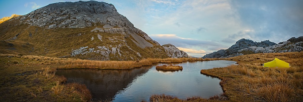
I got to the tarns about 2 pm. Whew. 1600 meters of climbing was a lot, but the day was gorgeous and the location was simply amazing. I was wishing I had the energy to make a dash up to the summit as it was only another 300 meters or so, but sanity prevailed and I spent the time getting camp set up.
I knew it would get cold pretty quickly once the sun angle went down, so I made sure I was prepared to dive into the tent when it got too cold. I was starving as well, so I had an early dinner. The views were amazing and the temperature was pleasant with little wind and some nice sunshine.
Around 5 pm, the wind picked up a bit and the clouds started to build. The weather forecast had been a bit iffy for Tuesday, but I was hoping it would hold for tomorrow’s peak climb. I wandered around taking pictures, stretching out the muscles and just enjoying the views. There was nobody else there. I was truly out there solo. I love doing solo trips and it does take some getting used to when you have absolutely nobody around you.
We like to watch the show “Alone” which is a survival show where they dump trained people into the wilderness to see how long they last. The super macho guys never make it. They almost all crater after 30 days. They are physically strong but fall apart mentally.
On a super mini scale, you can get that feeling in a very short time whenever you are in the wilderness all alone — even for a night. I like that it forces you to be introspective and thoughtful. You only have your thoughts.
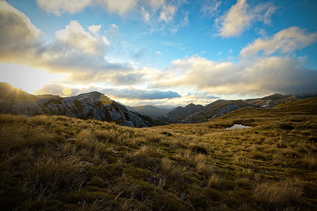
As the clouds built and the sun angle got low, the temperature dropped like a rock. The wind also kicked up which quite quickly chased me into the tent. I read my book for a while, which just happened to be “Fellowship of the Ring” and I tried to stay warm. I was having trouble getting my core temperature up and piled on everything I had. I think the effort of the day had drained me and my body just wasn’t producing enough heat yet.
I was glad I brought the mid-weight sleeping bag, but was wondering if I should have brought the heavy bag. At about 7 pm the wind really started in earnest and was banging my little tent around pretty hard. This was the first time I have had it out in any kind of weather at all, so I was hoping it was as good as advertised.
I dozed for most of the first part of the night because the wind was pretty fierce (refer back to the beginning of the blog) The good news is that I warmed up and even started to get hot. Thank you Mountain Chili and chocolate.
About 2 am, the wind stopped and it started to rain lightly. I did finally get some sleep now that the racket of the hurricane had abated, but it was not looking good for the next day.
I woke up about 5:45 am and it was still raining. Bummer. I dozed for a while trying to decide what the plan of action would be. I peeked out of the tent and it was total pea soup and raining lightly. You couldn’t see more than 20 meters. It didn’t look terribly thick, but the weather forecast hadn’t looked super-optimistic.
I mulled it over and decided that even if the clouds lifted later in the afternoon, I should probably pull the plug on the ascent to the peak. I would much prefer to do the climb on a nice day, especially since I was solo. It was a bit disappointing since I was so close, but I had a wonderful evening in the high alpine by myself and that was all I needed. Better to be cautious and come back another day.
I packed up my stuff, sent Susanne an a-ok beacon message and headed back down. On my way down, I passed a kiwi couple headed to the summit. In true kiwi fashion they were in shorts, with no gloves and very few clothes. I was freezing. How they do it, I will never know. They said they would just wait on the top until it cleared. I think they were being optimistic.
At the hut, I briefly considered just hanging there for the day to see if the weather would improve but opted to just keep going. It would be more fun to come back later now that I knew what I was up against.
The climb up the “Staircase” was tough, but the 1600 meters of descending was even harder on the old joints. I made it to the ute around 12:30 and felt glad I had made some good decisions and not pushed it on my own.
As our friend Jason, who is a pilot, says about flying “better to be down here wishing you were up there, than up there wishing you were down here.” Sage advice for tramping too.

Let me know what you think!