
Nelson Lakes
I will confess that we have only just scratched the surface on Nelson Lakes National Park and there are many areas that we have not set foot into yet. It is a big mountainous area with very few access points. The vast majority of the park is only accessible if you do a multi-day tramp. That said, some of our favorite day tramps are in the park and/or if you are feeling lazy, just hanging at the edge of Lake Rotoiti and taking in the view is pretty good in and of itself.
Day Tramping:
Most of the day tramps are in and around Lake Rotoiti just outside of St. Arnaud. There is a great visitor center (GPS -41.803893, 172.843986) in St. Arnaud that is worth a visit; they have heaps of information on tramping, plants, birds and what-not. They have some handy brochures as well to help you decide on what tramp to do.
Brunner Peninsula Nature Walk (1 hr)
If want something easy, there are a number near the visitor center/water front jetty. There is a nice walk around the peninsula just to the west of the jetty. After going around the peninsula you return via Baxter Street or Cotterell Street and View Road.
Lake Rotoiti Circuit. ( up to 23 km)
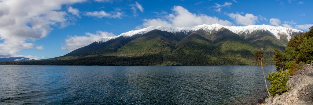
There is a trail that goes around the entirety of Lake Rotoiti; it is about 23 km to make the full circuit. It is a relatively flat route, but being New Zealand and all has the usual root ladders, gullies and creeks to navigate…none of which are all that bad.
You can shorten the hike by using the water taxi and do it one-way from one end of the lake to the other. It launches from near the campground and Lake Rotoiti jetty and costs around $35 per leg.
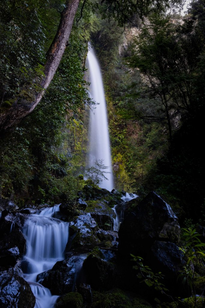
Western Shoreline: The car park for this hike is located (GPS -41.8126078, 172.812064) along the road to the Mt. Roberts Circuit.We have done the out and back along the western shore to Whiskey Falls. The first part of the hike is, frankly, pretty boring without much of a view. However, after that it really gets nice as you are hiking along the shoreline with great views of the mountains. Whiskey Falls is worth the side hike up to it. If you go all the way to the end you will reach the Coldwater Hut.
Eastern Shoreline: By our estimation, the Eastern Shoreline is more interesting, although you do not get Whiskey Falls. The forest is much nicer, the birds are great and views are good for the entire thing. We took the taxi to the Lakehead Hut and hiked back (10 km). You can do it the other way as well. The trailhead ends (or starts) at the Water Taxi jetty.
End of the Lake to Swing Bridge Return: (10 km)
This is a very popular option for people using the water taxi. You can do it from either the Coldwater or Lakehead Hut. Or you can start at one and end at the other. It is a flattish hike up the valley with amazing view of the surrounding mountains. It is part of the Sabine-Traverse circuit, which is one of the more famous multi-day tramps in the area.
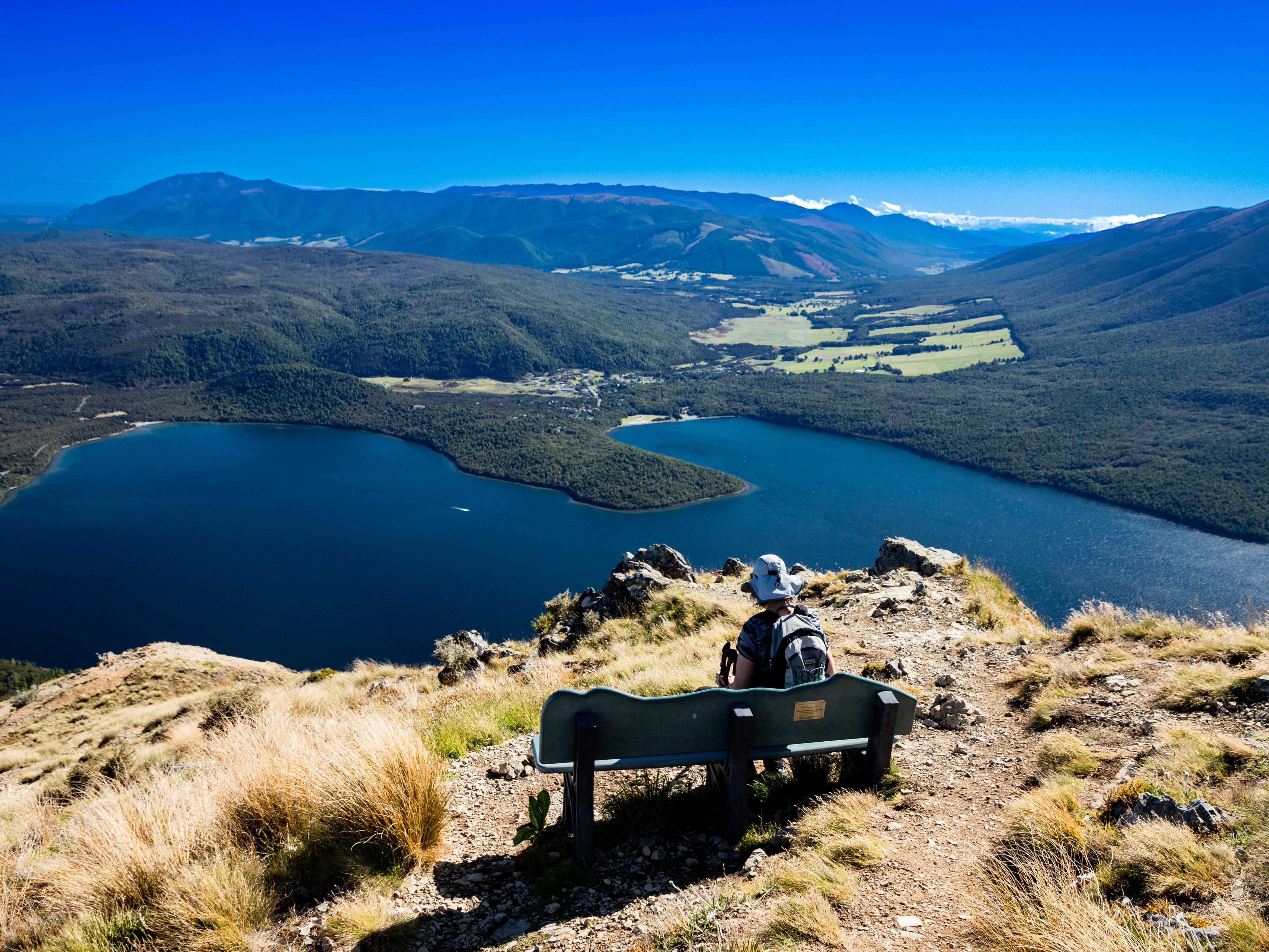
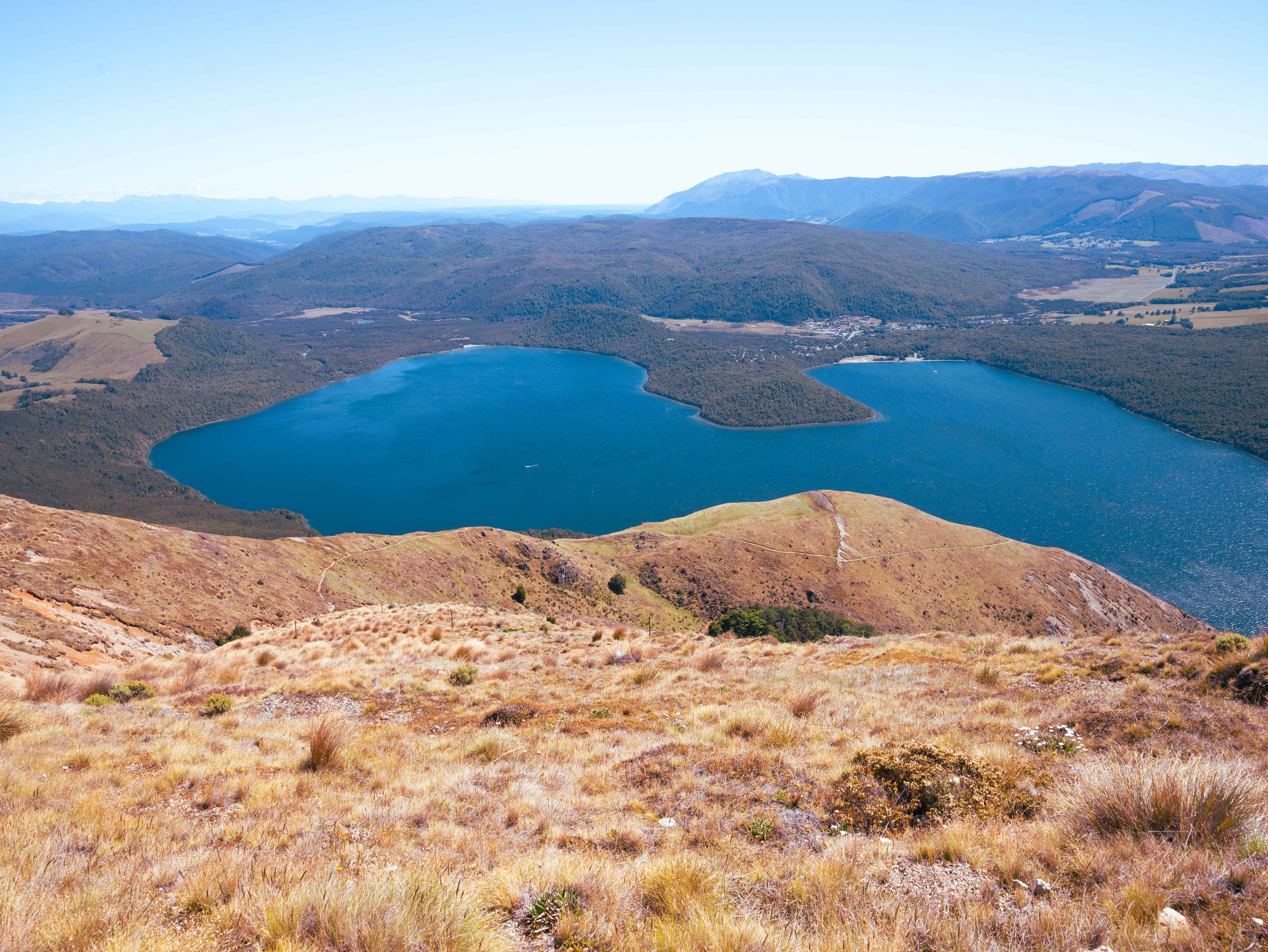
Mt.Roberts Circuit (10 km, 600m climbing)
Saving the best for last. This is a truly amazing hike. If you want views, this is the hike for you. We like to do the hike in an anti-clockwise direction because you get the steep climb out of the way at the beginning and the views coming back down are better. Park at the lower parking lot (GPS –41.821892, 172.811683) which is where Paddy’s Track starts (and you will end). Hiike up the road a short distance to the start of the Pinchgut trail. There is a toilet at the upper parking lot, but not at the lower one.
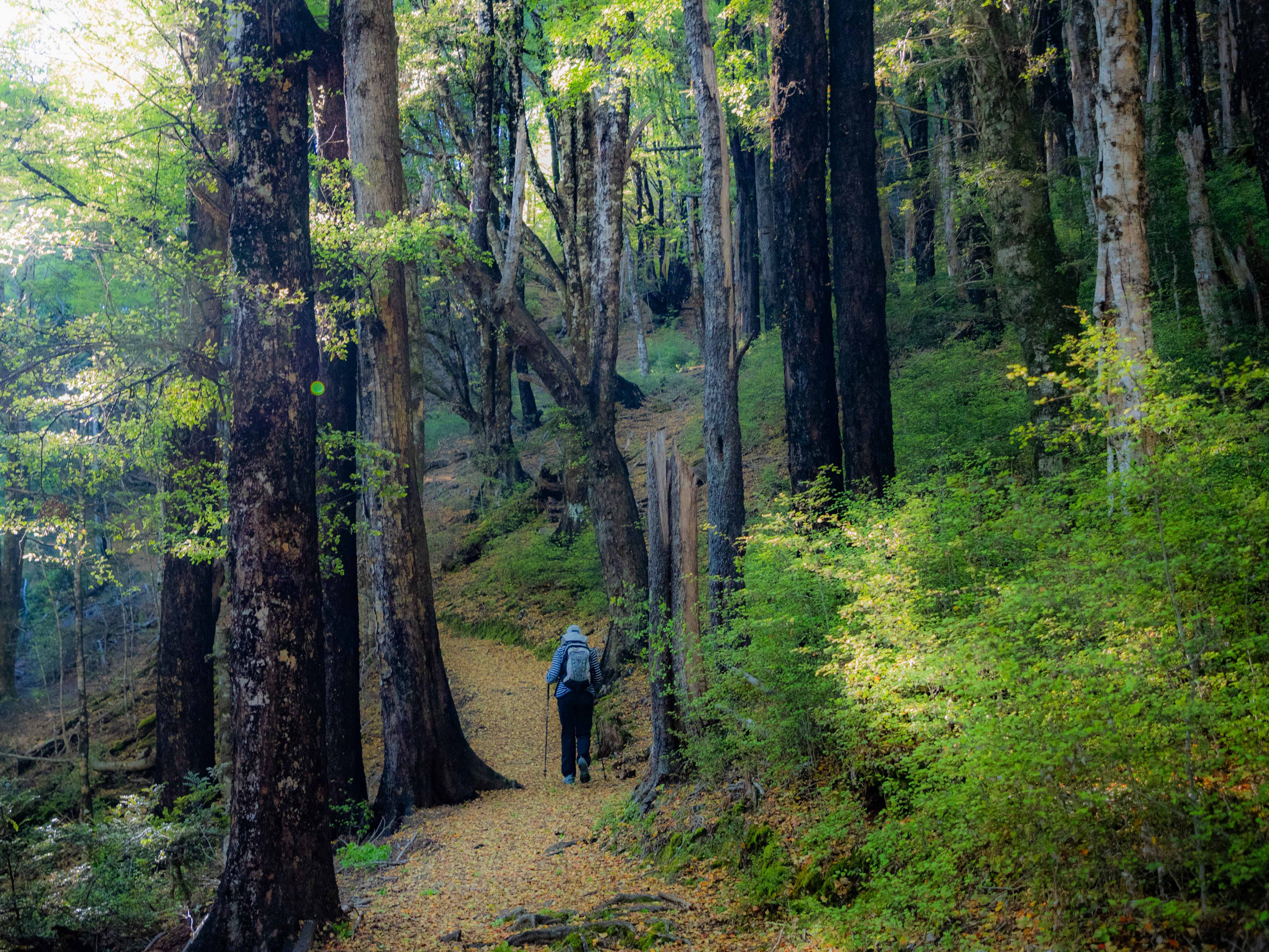
The first part of the climb is up steeply through a beautiful section of beech forest. After about 450 m of climbing you will reach tree line and the gradient starts to ease up. After a gentle climb through the tussock you will reach a small ski hut. There is a catchment water tank there if you need water. Most kiwis don’t bother to treat it, but I always do since I have my handy-dandy Katadyn filter.
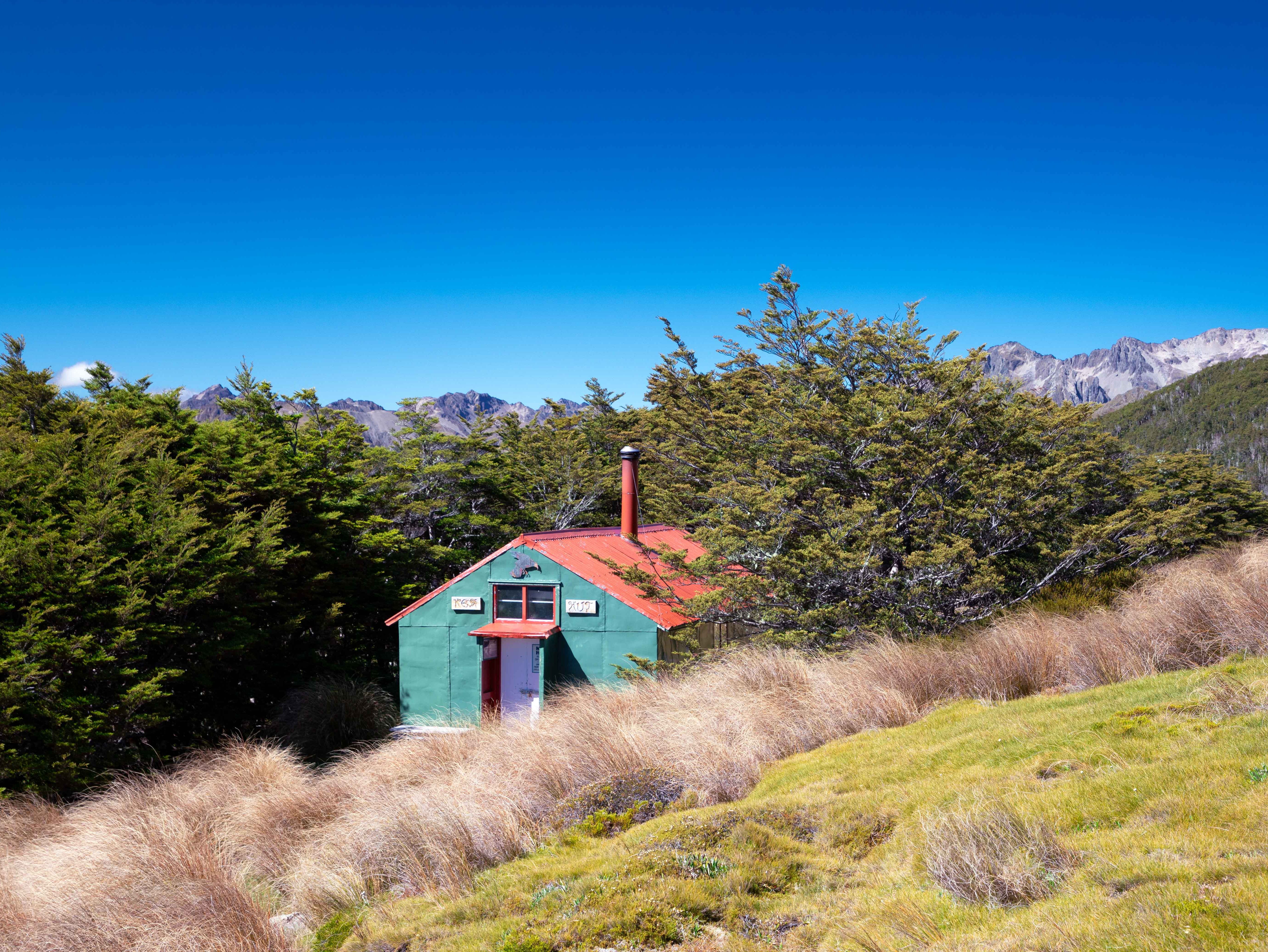
Shortly after you will reach a fork in the trail. So take it. Ok, bad joke. If you continue upward, it would ultimately land you at Angelus Hut. Turn left and start your descent. You will see a private ski hut and then you will come to the Bushline hut (A DOC hut). Make sure you walk over to the edge and get the view of the lake…amazing!
A good summary of the hike can be found here at this link
HUT-to-HUT Tramping
There are a lot of trips you can do in the park. Be aware though, that much of it requires good experience in the back country and excellent navigation skills. Many of the “trails” are routes; meaning that you will have to navigate freeform through the mountains with an occasional marker. There will not be a set trail.
Sabine Travers: ( 4 to 7 days, 80 km)
A must do in many people’s minds….although I have not done it yet. On the agenda for next year. It is a tough hike, but gives you are great sense for the intensity of the mountains in the park. There are numerous trip reports on the web and to the DOC info lives here and a handy brochure that tells you everything you need to know.
Angelus Hut: (2 Days, 22 km, 900 m climbing)
You can do this as an out-and-back along Roberts Ridge or turn it into a circuit and come back via the Speargrass trail. This is supposed to be one of the prettiest DOC huts anywhere. It is quite popular, so a booking is required. Here is a nice trail report to orient you to the beauty of the place.
Kayaking
There is pretty good kayaking in the lakes. One thing to note though is that the wind can be pretty strong as the mountains create quite a wind tunnel. You can rent kayaks at the water taxi office.

Let me know what you think!