
Cobb Valley, Kahurangi National Park
HIKE INFO:
To Sylvester Lakes Hut:

        LENGTH: 5.2 km (3 mi) to Sylvester Lakes Hut
        ELEVATION GAIN: 547 m (1751 ft)

Sylvester Lakes Hut to Iron Hill Summit:

        LENGTH: 8.4 km (5.2 mi) to Summit (1695m)
        ELEVATION GAIN: 532m (1705 ft)

TRAIL HEAD GPS: -41.104642, 172.683314

January 12th, 2026
The Cobb Valley is located just South of Takaka. In order to reach the trailhead requires a long (25km) drive along a road. In bad weather, this road can be hazardous to travel on. The trail head is located on the east end of the Cobb Reservoir, just across the Cobb Reservoir dam.
I was planning on doing the Travers-Sabine circuit in a couple of weeks, so I wanted a good 1 night tramp that wasn’t too killer. I fished around the DOC map and spotted Sylvester Lakes Track. It was a short hike with some good options for day hikes out of the Sylvester Lakes hut.


From the car park, you make your way through a Manuka grove until you pop out into the open and can see the lake. It is a pretty uninteresting start to the hike, but don’t despair, the rest of the hike is pretty nice. There was a group of 4 people heading out just behind me who were planning on camping at the lakes, rather than staying in the hut.
Once you traverse the meadow, you enter the beech forest and start up the hill. The trail is well formed, and the gradient is consistent but not too steep. The bird songs were really lovely as I walked through this stretch of forest.
After a few switchbacks, you break out above tree line where the view of the mountains opens up. After a short while you can get a glimpse of the hut up on the ridge.

The hut is a lovely 12-person standard hut with a dual-platform setup. Very classic. I had picked this date because the website had shown just 1 other person booked to be in the hut. She was there when I arrived, just around noon. Sophia was an EMT from Motueka and was quite an amazing tramper. She had decided, like me, to come out for just a quick one-nighter. She had stayed with some friends the night before at the Cobb Hostel, a little DOC cabin near the trailhead that you can rent. I guess it even has a shower!


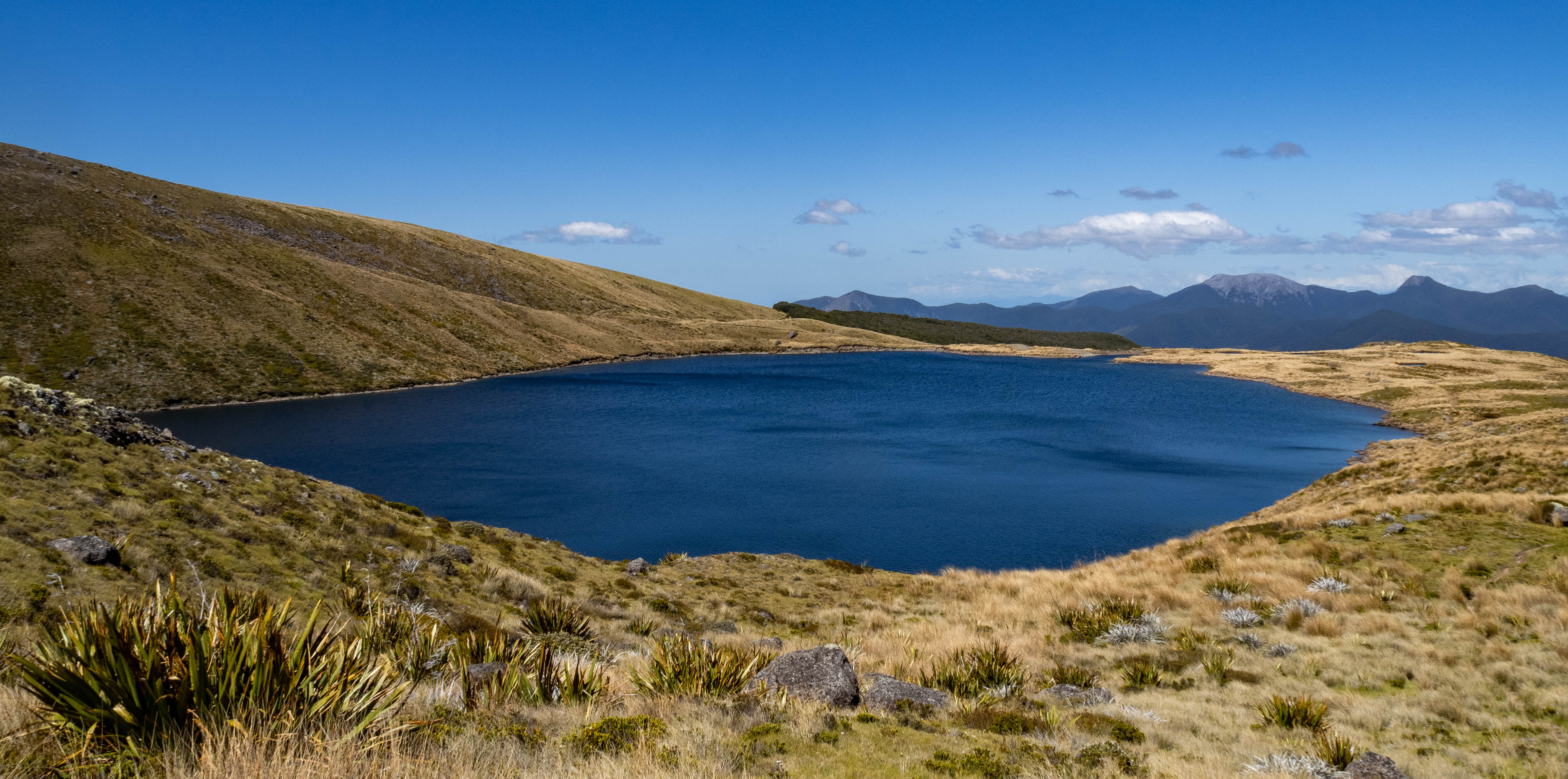
The original plan was to climb up to Iron Hill the following day. I had some lunch and then just wandered up to check out the lakes. They were quite beautiful, and there were a number of lovely-looking camp areas.


It was such a beautiful day, I just kept going. I thought, “I’ll just go up to the upper lake and check out the route to Iron Hill.” It was a bit boggy in parts but mostly it was easy going. There are several apparent trails, but it really didn’t matter which one you took as long as you aimed at Iron Mountain. The trail took you past several small, shallow lakes before reaching the highest lake that sits at the base of Iron Hill. There were more nice-looking camp areas here as well.


At this point, you are about 300 meters below the Iron Hill peak. The trail cuts up steeply through some limestone formations that looked a bit intimidating. It was 3:45 pm, and I was having a great time, so I continued to “just check out the tricky part for a little while.”


As I climbed, the views just kept getting better. I checked my watch, and it was 4:00 pm. I decided I could keep going, but my “must turn around” time was 5:00 pm — whether I had reached the summit or not.
The going wasn’t as bad as it looked, and I got to the ridge by 4:30 pm. To reach the summit, you have to do a short down climb and then up a steep rocky bit. There is a bit of exposure on the way up, but you would really have to mess up to fall off.

The view from the top is worth the effort. It was a perfect day, and I hung out for about 10 minutes, enjoying the view. For the ridge you can continue on into the Lockett Range where there are a number of other lakes and destinations — I will have to come back and do a longer tramp and explore these.
I headed back down the steep section and reached the upper lake by 5:00 pm. The four people I had seen in the parking lot were setting up their camp for the night. What a great camp spot.
When I got back to the hut, there were two more women there. Both German, but one lived in Christchurch and was a registered nurse. They were lovely and we had a nice evening chatting.
In the morning, I decided to amble back down to the Ute and head back home. I considered another hike, but my ankle was sore. Instead, I stopped and picked up a bunch of limestone rocks to take home for the garden.
I would definitely do this hike again. It is a great short hike that gets you a feeling for the Kahurangi National Park without having to kill yourself
Leave a Reply